


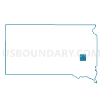
VTD-precinct 4, Miner County, South Dakota
About
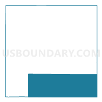
Outline

Summary
| Unique Area Identifier | 667575 |
| Name | VTD-precinct 4 |
| County | Miner County |
| State | South Dakota |
| Area (square miles) | 108.14 |
| Land Area (square miles) | 107.90 |
| Water Area (square miles) | 0.24 |
| % of Land Area | 99.77 |
| % of Water Area | 0.23 |
| Latitude of the Internal Point | 43.89952930 |
| Longtitude of the Internal Point | -97.54013730 |
Maps

Graphs
Select a template below for downloading or customizing gragh for VTD-precinct 4, Miner County, South Dakota


Neighbors
Neighoring Voting District (by Name) Neighboring Voting District on the Map
- Farmington-LeRoy-Clarno-Orland precinct, Lake County, SD
- Herman-Winfred precinct, Lake County, SD
- VTD-precinct 2, McCook County, SD
- VTD-precinct 3, Hanson County, SD
- VTD-precinct 5, Miner County, SD
- VTD-precinct 6, Miner County, SD
- VTD-precinct 6, McCook County, SD
Top 10 Neighboring County Subdivision (by Population) Neighboring County Subdivision on the Map
- Clarno township, Lake County, SD (182)
- Fairview township, Hanson County, SD (162)
- Clearwater township, Miner County, SD (162)
- Sun Prairie township, McCook County, SD (148)
- Winfred township, Lake County, SD (144)
- Howard township, Miner County, SD (140)
- Spring Lake township, Hanson County, SD (121)
- Canova town, Miner County, SD (105)
- Vermillion township, Miner County, SD (90)
- Canova township, Miner County, SD (82)
Top 10 Neighboring Place (by Population) Neighboring Place on the Map
Top 10 Neighboring Unified School District (by Population) Neighboring Unified School District on the Map
- Madison Central School District 39-2, SD (8,762)
- Howard School District 48-3, SD (2,375)
- McCook Central School District 43-7, SD (2,300)
- Hanson School District 30-1, SD (1,854)
Top 10 Neighboring State Legislative District Lower Chamber (by Population) Neighboring State Legislative District Lower Chamber on the Map
Top 10 Neighboring State Legislative District Upper Chamber (by Population) Neighboring State Legislative District Upper Chamber on the Map
Top 10 Neighboring 111th Congressional District (by Population) Neighboring 111th Congressional District on the Map
Top 10 Neighboring Census Tract (by Population) Neighboring Census Tract on the Map
- Census Tract 9641, Hanson County, SD (3,331)
- Census Tract 9646, McCook County, SD (3,213)
- Census Tract 9616, Miner County, SD (2,389)
- Census Tract 9601, Lake County, SD (2,337)
Top 10 Neighboring 5-Digit ZIP Code Tabulation Area (by Population) Neighboring 5-Digit ZIP Code Tabulation Area on the Map
- 57058, SD (1,973)
- 57311, SD (1,616)
- 57349, SD (1,493)
- 57076, SD (521)
- 57321, SD (388)
- 57374, SD (343)